In this third and final part of our Marloes Peninsula trilogy I wanted to share with you some of the photos we took to record our walk. As I have said before, on many occasions, we plan our walks and navigate with confidence in order to enjoy the sights and the sounds of the great outdoors. It was a beautiful day when we walked the Marloes Peninsula and we stopped to look around many times: and we had a leisurely lunch down by the water’s edge on Musselwick Sands. We took 81 photos – but they are not all here!
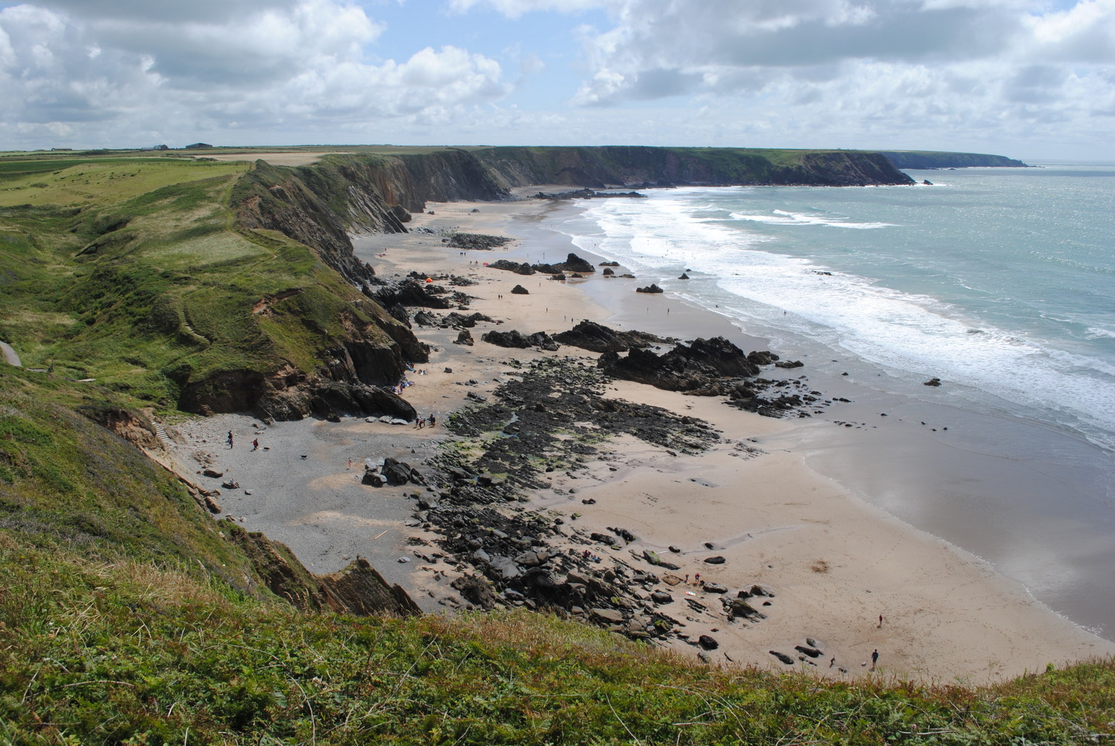
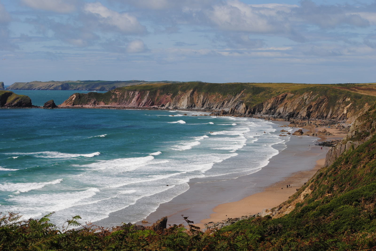
Our first encounter with the coast was at Marloes Sands near our car park. The yellow sand and ancient red and black rock formed a beautiful contrast with the bright blue of the Atlantic and the sharp white of the gentle surf. The picture on the left was taken looking ESE along the sands and the photo on the right was taken from the other end of the Sands looking WNW back along the cliffs we had just walked.
It was just beyond this point that we started to look for the transit line along the taxi-way which was our point to leave the Coastal Path and move inland.
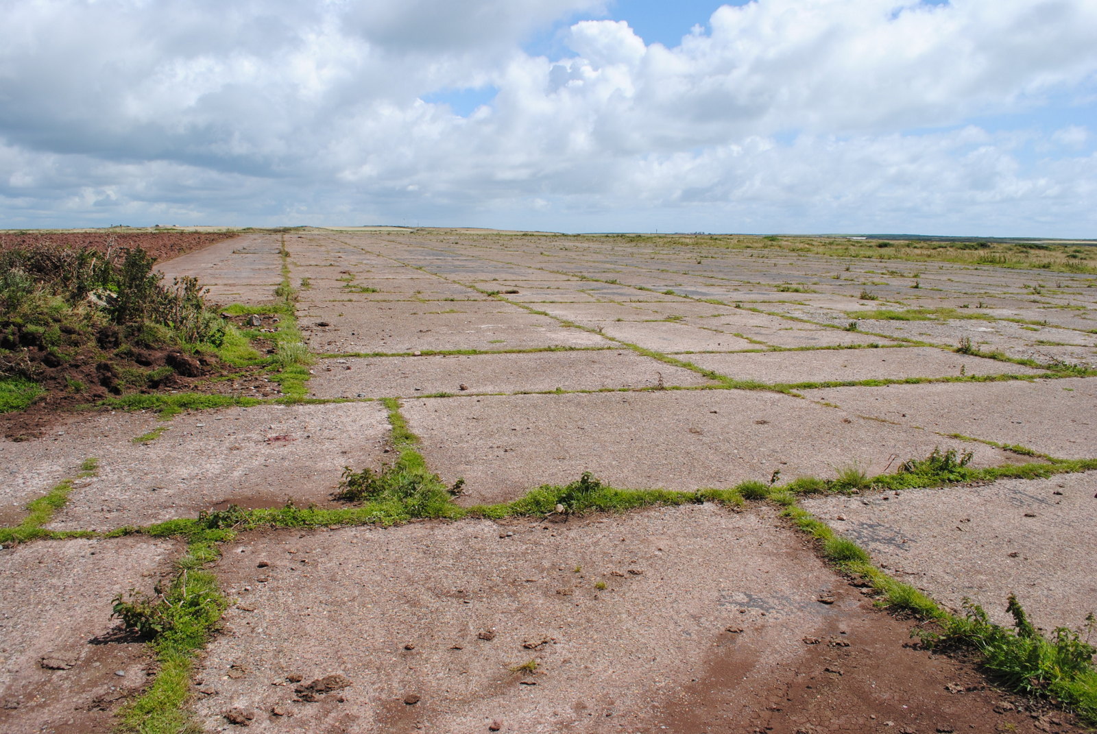
Below is one of the three main runways at what was once RAF Dale. You can see how huge these runways are and although grass now grows through the cracks you can still gain a feeling for the scale and efficiency of the operation which took place at this vital Coastal Command airbase during WW2. If was particularly poignant for me because my father spent his war years in the Merchant Navy and I spent a few moments day dreaming about whether aircraft from this airfield ever flew out to meet and protect one of the convoys he sailed in.
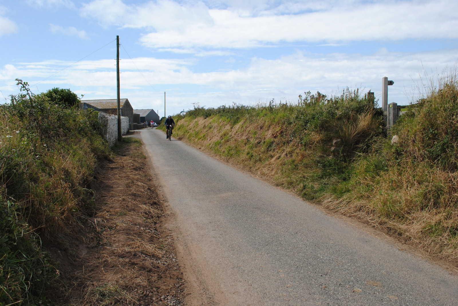
In Part 2, I talked about the value of overshoot features. We were looking for the way marker in the right hand foreground of the picture below and beyond that is Marloes Court House – our overshoot feature. Although this way marker is obvious, others may not be and we had not paced the 500meters of high-banked narrow lanes prior to reaching it. The overshoot gave us the confidence to know that this was the marker we were looking for.
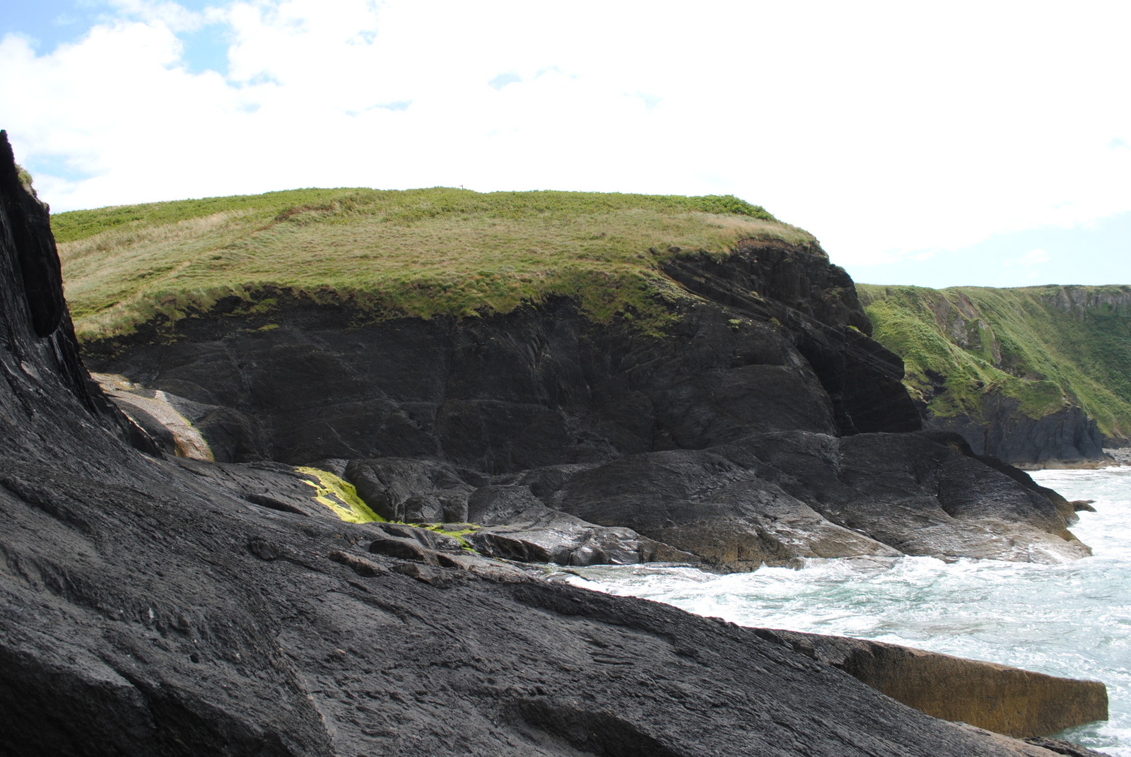
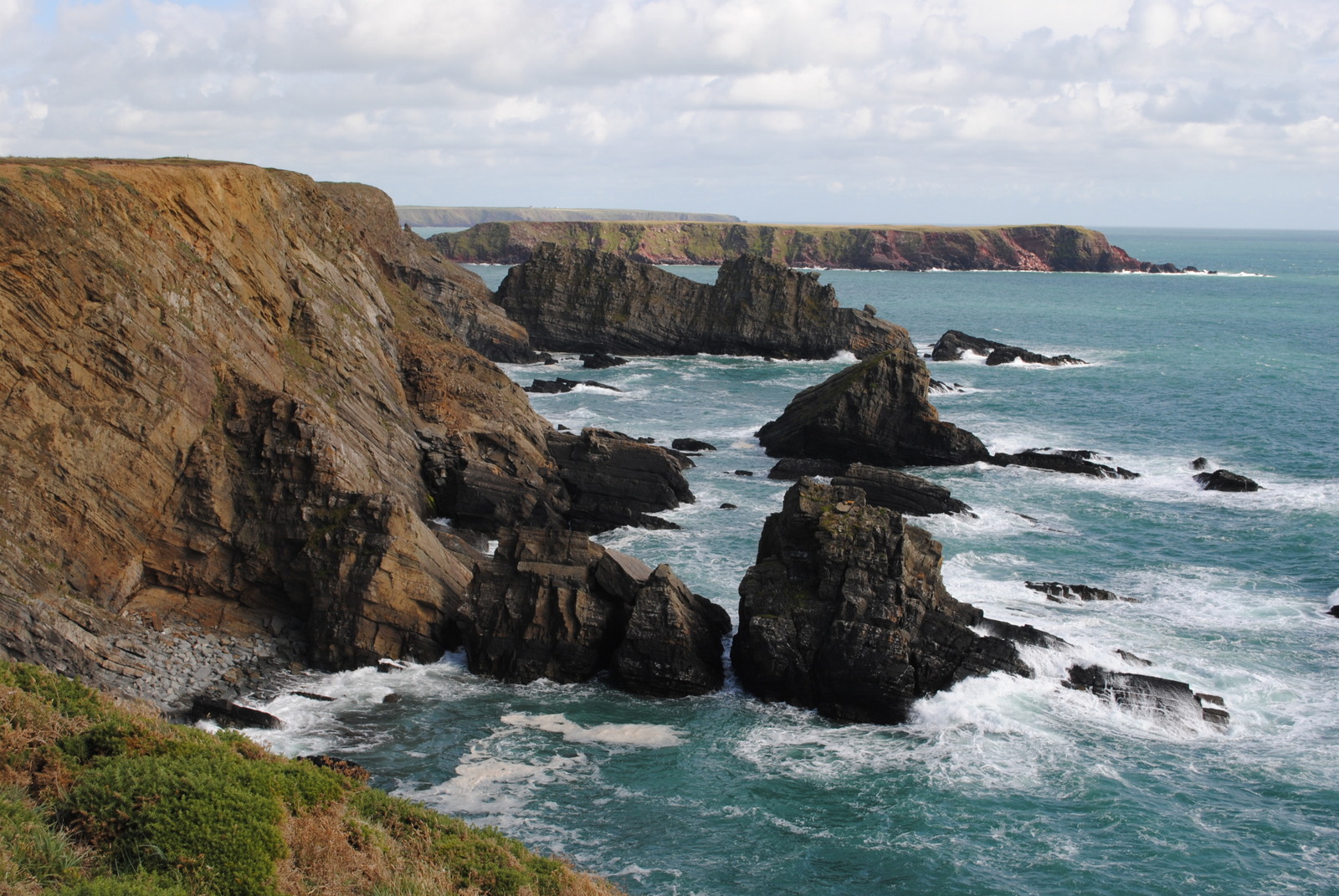
By the time the coastal path and ocean on the Northern side of the peninsula came into view, we were ready for lunch and our chosen venue – Black Cliff at Musselwick Sands – was not too far away. These rocks are striking because of their uniform colour and twisted formation but being so close to the sea, my main concern was the rise of the tide and whether we might get cut off. As it turned out we were fine. It’s a beautiful spot chosen because it provided shelter from the breeze and it was wonderfully secluded.
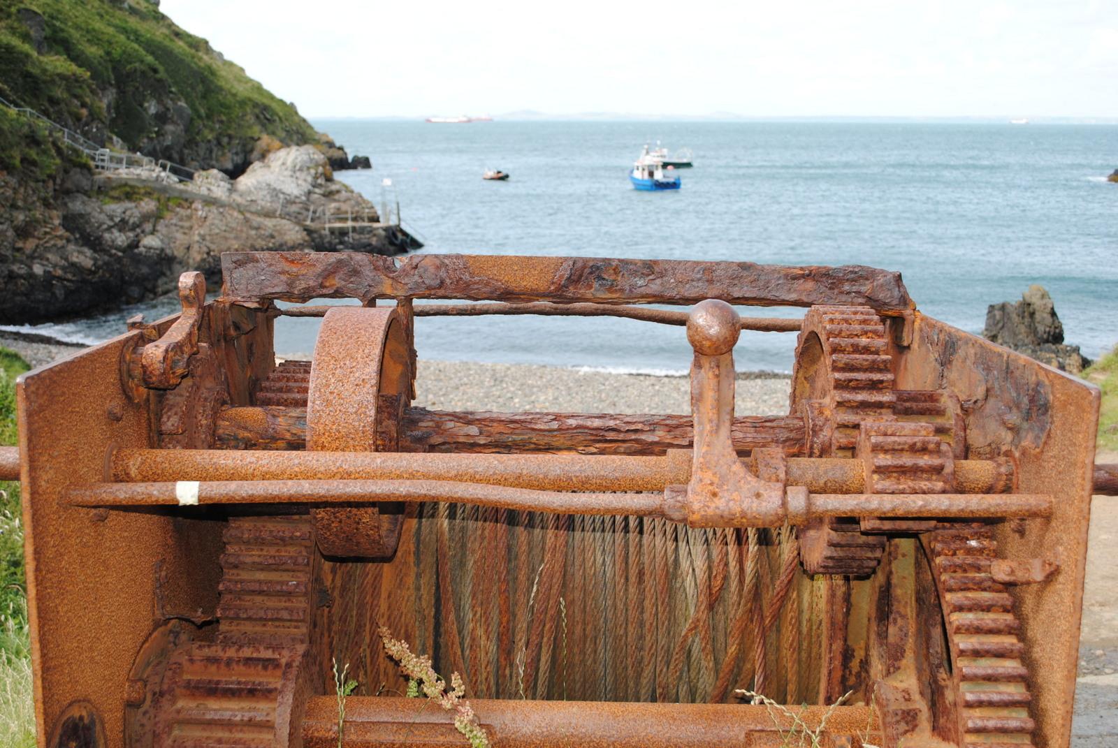
After the post-lunch leg along the cliff tops we eventually reached the small bay from which run the boat trips to Skomer Island. I couldn’t resist trying to take an ‘arty’ shot of this rusting old winch (below). This bay has been used to moor fishing boats for centuries and although the winch probably only dates back for about a century, it has probably seen many a sight which has now slipped, forever, into obscure history. I should have looked for a date on it – perhaps next time.
Just 100 yards up the old slipway we found the pilgrims cross (below). Look carefully at the vertical stone let into the more recent stone wall and you will see it quite clearly. I’d seen a very similar cross near Nevern in North Pembrokeshire and I am guessing that this one was positioned for the benefit of the pilgrims crossing from Ireland en-route to St Davids.
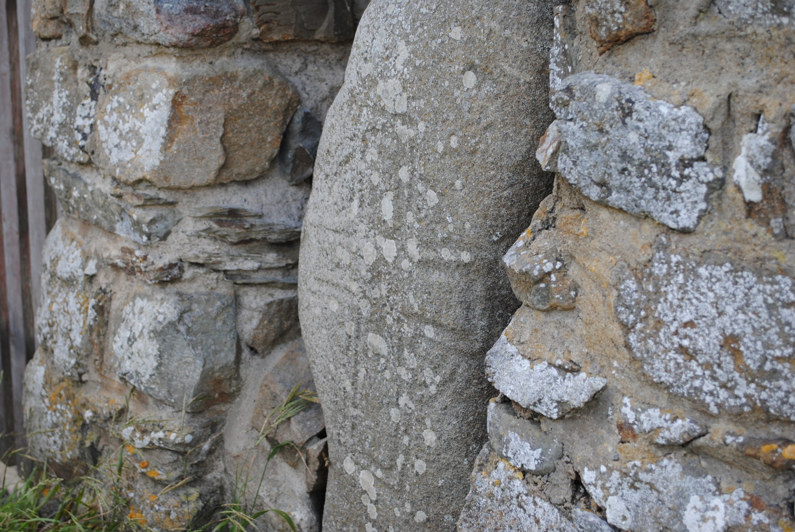
Along with the bank and ditch of another enormous Iron Age hill fort below which the cross stands, it is clear that this has been an area of strategic power and religious significance for millennia: natural beauty, history and religion inextricably linked and comfortably intertwined on the western tip of Great Britain! Yet again, as I find while wandering in the Preseli’s, the mysticism of the past calls out to those who take the time to dwell a few moments and open their mind to hear the calling of our ancestors. I love these secret, hidden little gems – this is what makes Pembrokeshire so priceless.
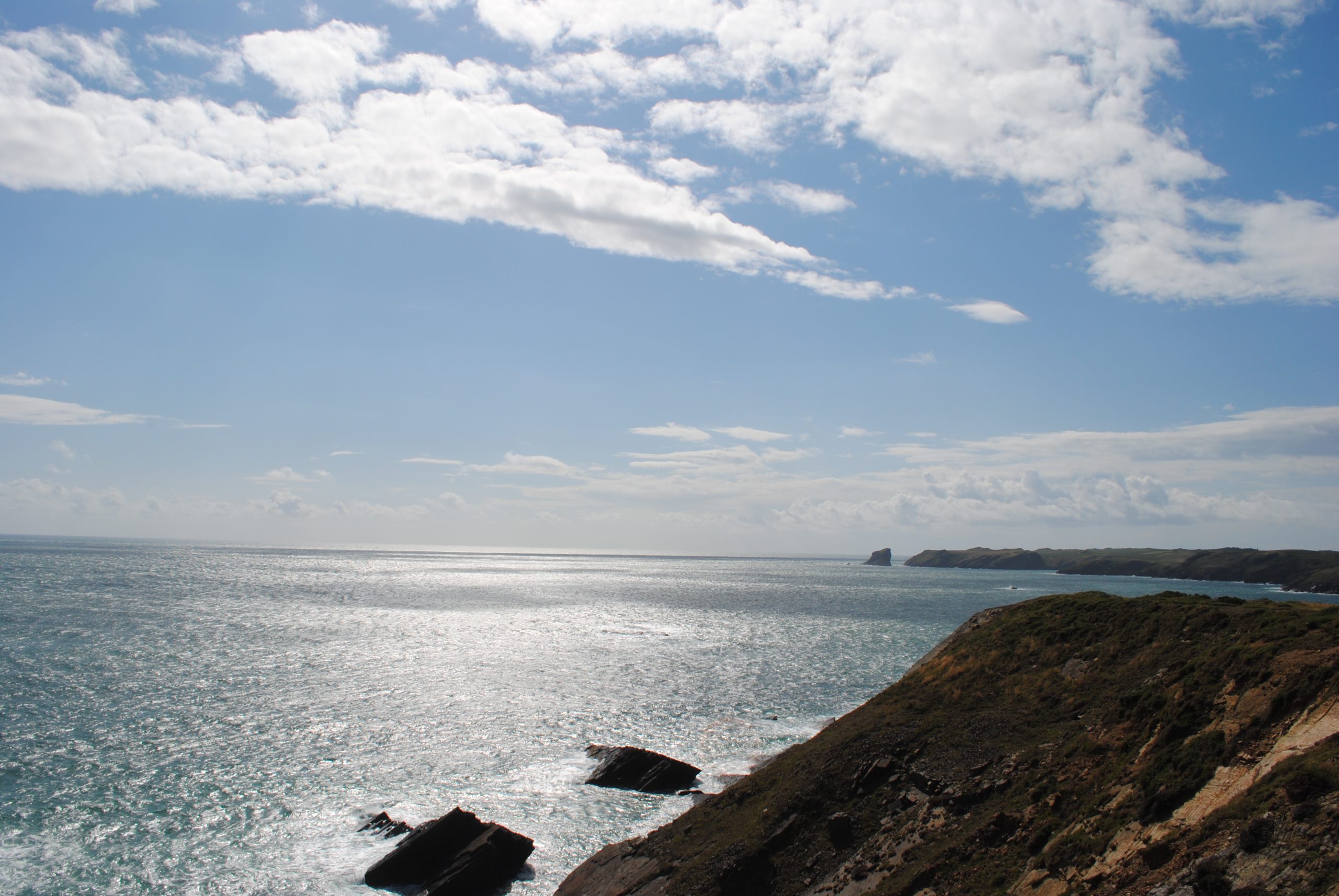
Dragging ourselves away we walked back up onto the cliffs for the final push back to the car. The views behind us over Jack Sound and Midland Isle to Skomer Island were set against the polished and shimmering ocean (below) and in front of us (looking ESE) we were rewarded with our final view for the day of the rugged beauty of the Pembrokeshire Coast at its best (last picture).
Walking Tip No20: Don’t forget to look back. Not only might it give you a clue about, or confirmation of, your position but there could be a cracking view worthy of a photo!
I should have taken a photo of the ice cream van in our car park but I was too eager to devour my reward for finishing the walk!