The other day I came across an article written Richard Ellis of the Guardian in 2012 – The National Trust’s top 10 Pembrokeshire Walks. His opening line was ‘Pembrokeshire’s dramatic and varied coastline is a joy for walkers, taking in stunning bays, beaches and cliff tops, volcanic headlands, glacial valleys and quaint towns.’
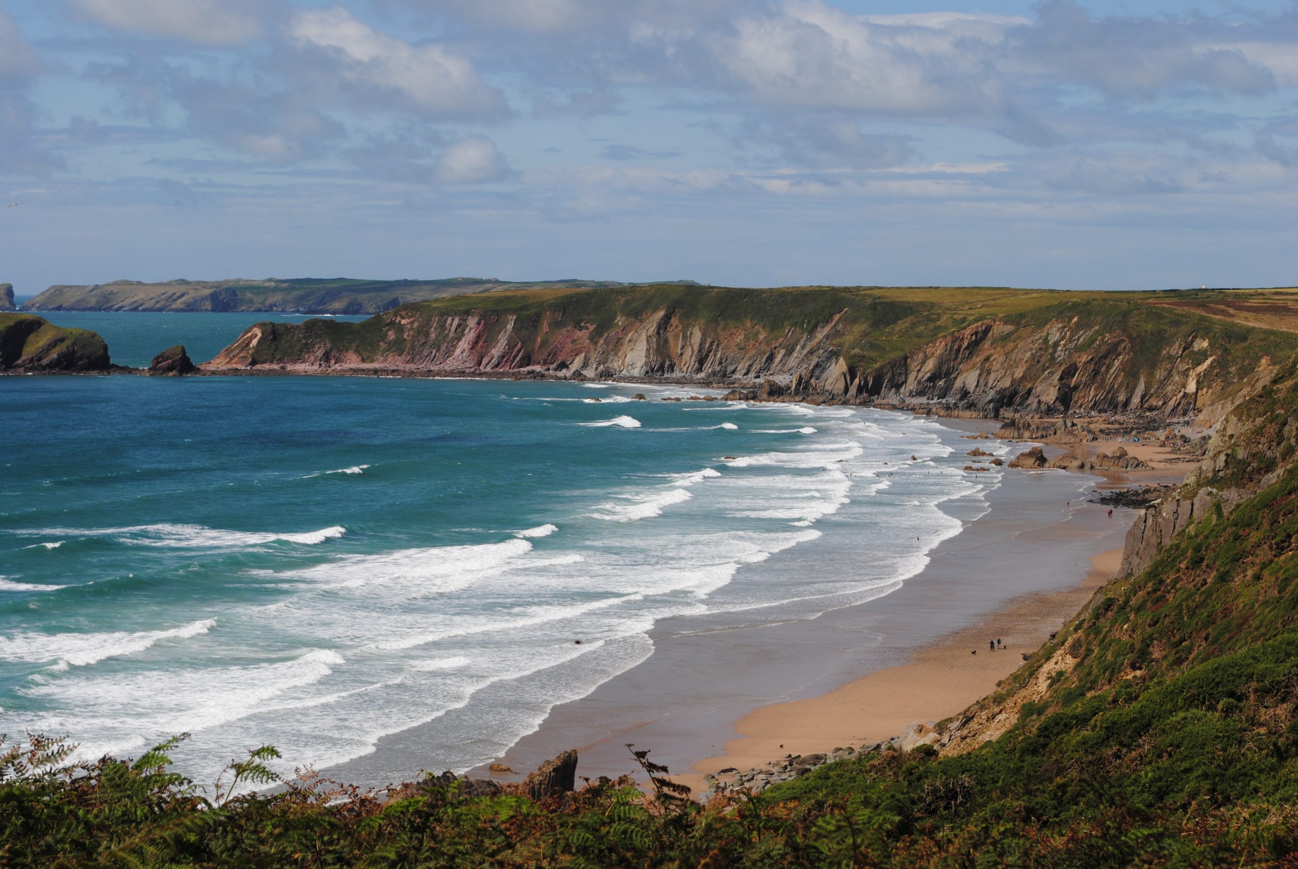
I was delighted to see that the Marloes Peninsula (SM775085) (below)was featured in the top spot and because Carol and I had walked there only the week before I thought it was a sufficient coincidence to warrant blogging about.
I thought it would be good to use this great walk to demonstrate how all the theory of pre-planning, the actual navigation around the walk and the pleasure of drinking in the stunning scenery and ambiance – i.e the reason for going to the peninsula in the first place(!) all comes together.
So in this first part I want to take you through the planning from deciding to go to the Marloes through to leaving the house with everything we needed. In Part Two we will describe the various navigational challenges that we expected and how we dealt with them, and in Part Three we will describe the scenery and some of the history behind what we saw (flora, fauna and something big happened here in the past!).

Walking Tip No 13 – the planning steps described can be adapted to any walk that you want to plan. Consider them to be an essential check list of considerations.
Planning
Carol was not working during the first half of the week commencing 27 July 2015 and so we decided to get out for a good walk sometime during that period.
The Aim This was quite easy for us because since we arrived in Pembrokeshire we have been walking stretches of the Coastal Path and our long term aim is to ‘bag’ all 187 miles of it in due course. So it made sense to find another stretch to tick off. Another ‘standing aim’ of our walks is to consider where we can eat/drink afterwards either at the location of the walk or on route home.
The Weather A look at the forecast showed that the Tuesday would be dry and sunny all day with temperatures around 16 ⁰C. Wind was forecast to be 8-10 mph from the South West – so it would be blowing off the sea and would feel quite warm. As the best day it made sense and although I had a marketing meeting early that morning which I knew would be finished by 11:00, the weather app on the iPad also told me that sunset was 21:16, thus we would still have a good 10 hours of daylight available to us. So that was the weather forecast consideration.
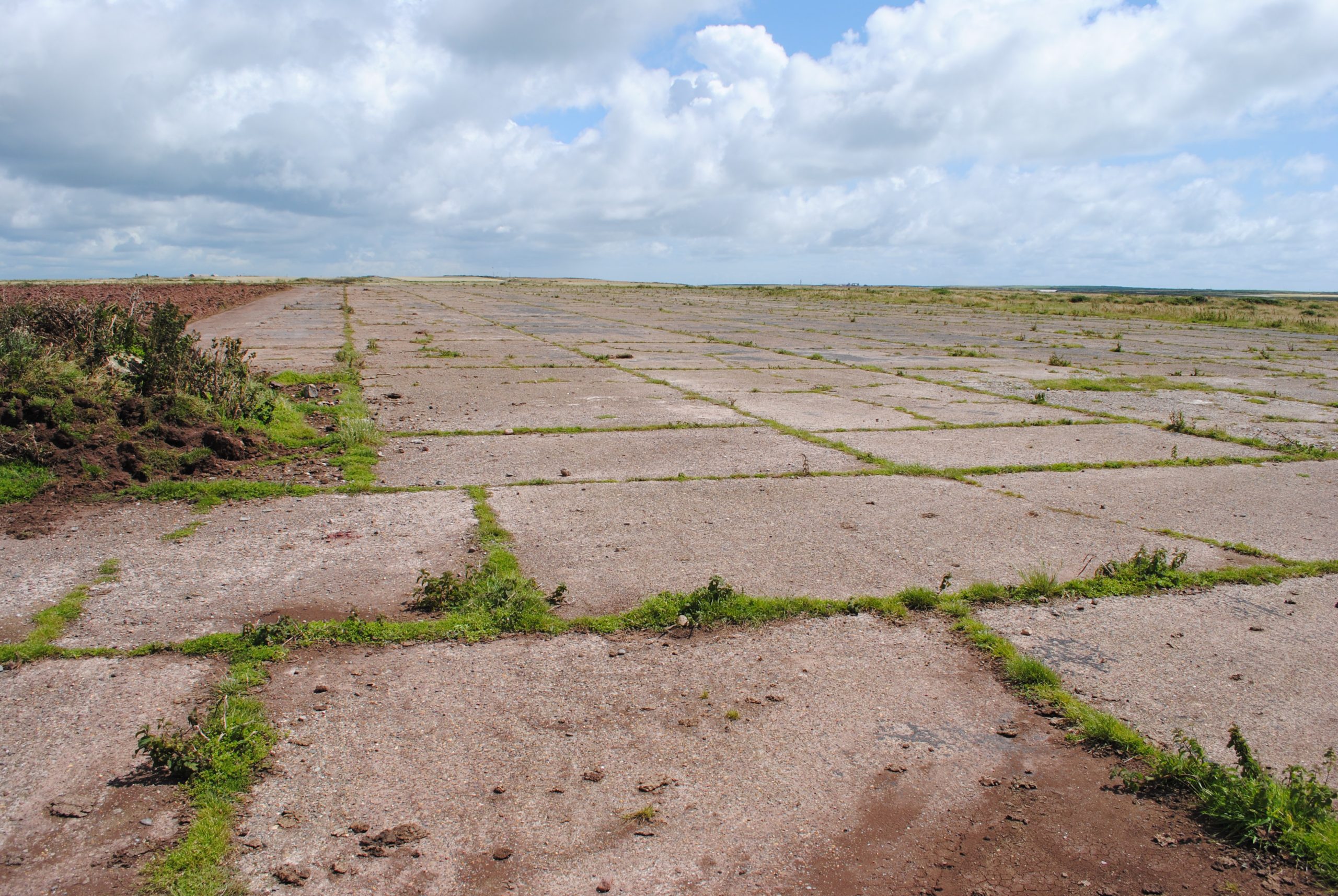
Suitable Location My meeting was in Pembroke Dock and so it made sense to look in that general area. Using the 1:25,000 scale OS map we scanned the coastline and saw various options for coastline nearby. But our eyes soon settled on the Marloes Peninsula and Martin’s Haven (above) in particular because we had enjoyed a really fantastic evening there in the Spring watching the sun set over Skomer Island and Jack Sound and we had promised ourselves that we would walk the whole peninsula one day: location sorted!! Using my fingers I ‘walked round an approximate route – about 10 km and at 3km/hr plus stops we probably needed about 5 hours. Martin Haven from Pembroke is no more than one hour so 11:00 (meeting finished) plus 1hr travel and 5hrs walking = we should be safely back at the car about 17:00. Perfect timing for a short drive to the pub in Marloes for something to eat and then another hour to home and Emmerdale!!
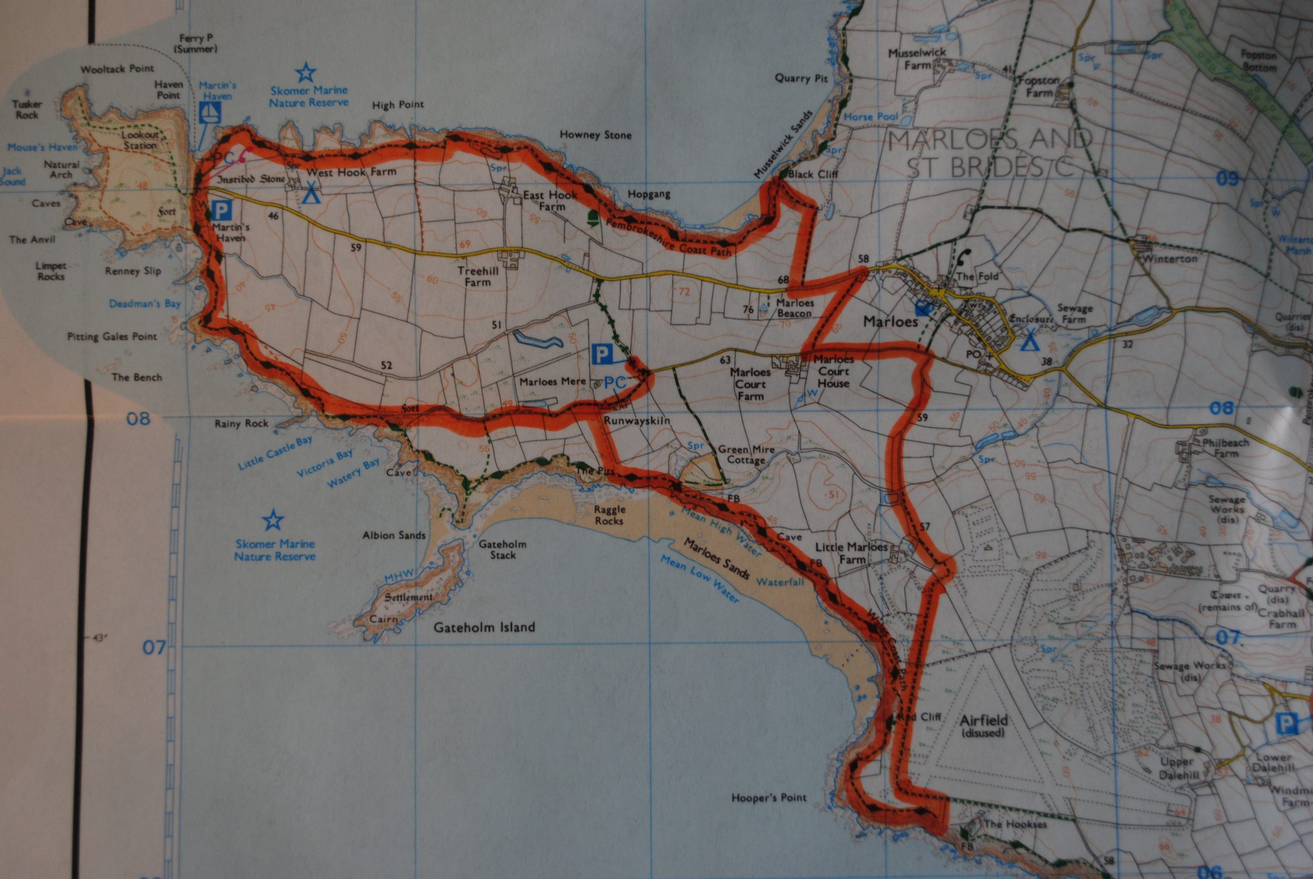
The Route My rough calculations were purely to confirm the feasibility of the outline plan and all seemed fine. But I needed then to look more closely at the map – the devil is in the detail. With the help of the OS planning application (I really recommend the small subscription fee for one year) I plotted a more detailed route which took in several interesting features and landmarks. The application works out the accurate distance and the total elevation thus allowing me to use Naismith’s calculations for the duration of the walk. The modified route developed into 13km and the total ascent along the whole walk was 307m. Re-applying Naismith meant that I needed to plan on a duration of 7hrs (that would account for short stops, lunch, ascents and a fudge factor – for the loo and photos). Importantly I was now confident about two key points:
- The route was navigationally and physically within our capabilities.
- We had enough time to complete it is day light (back to the car by 19:00).On the downside it looked like Emmerdale or the pub would have to be sacrificed! Tough call, but thankfully we could record Emmerdale and so the pub survived the chop!!
Walking Tip No 14: Naismith’s Rule should be at the core of calculating the duration for all hill and moorland walks.
So route planning was completed but, because we had done the planning four days ahead, we would need to keep an eye on the weather forecast in order to know if the route might need modification.
Clothing and Kit And the weather would dictate the choice of clothing to wear and carry. Light winds can feel chilly, especially as the walk continues and energy levels drop. They can also quickly cool you down when stopped for lunch or even a short break and so clothing-layer management would be important. As it happened the forecast held and so on the morning of the walk we both wore a base-layer and a thin fleece on top, with summer walking trousers (that can unzip at about knee height). Despite the high probability of dry and firm ground we both wore our three season walking boots because many parts of the coastal path are uneven (see my blog of 3 July 2015 about the sting in the tail of Coastal Path walking) and quite hilly and the rigidity of three season boots give you that extra ankle protection on sometimes awkward terrain. We also took out walking poles to provide additional stability on some of the elevations.
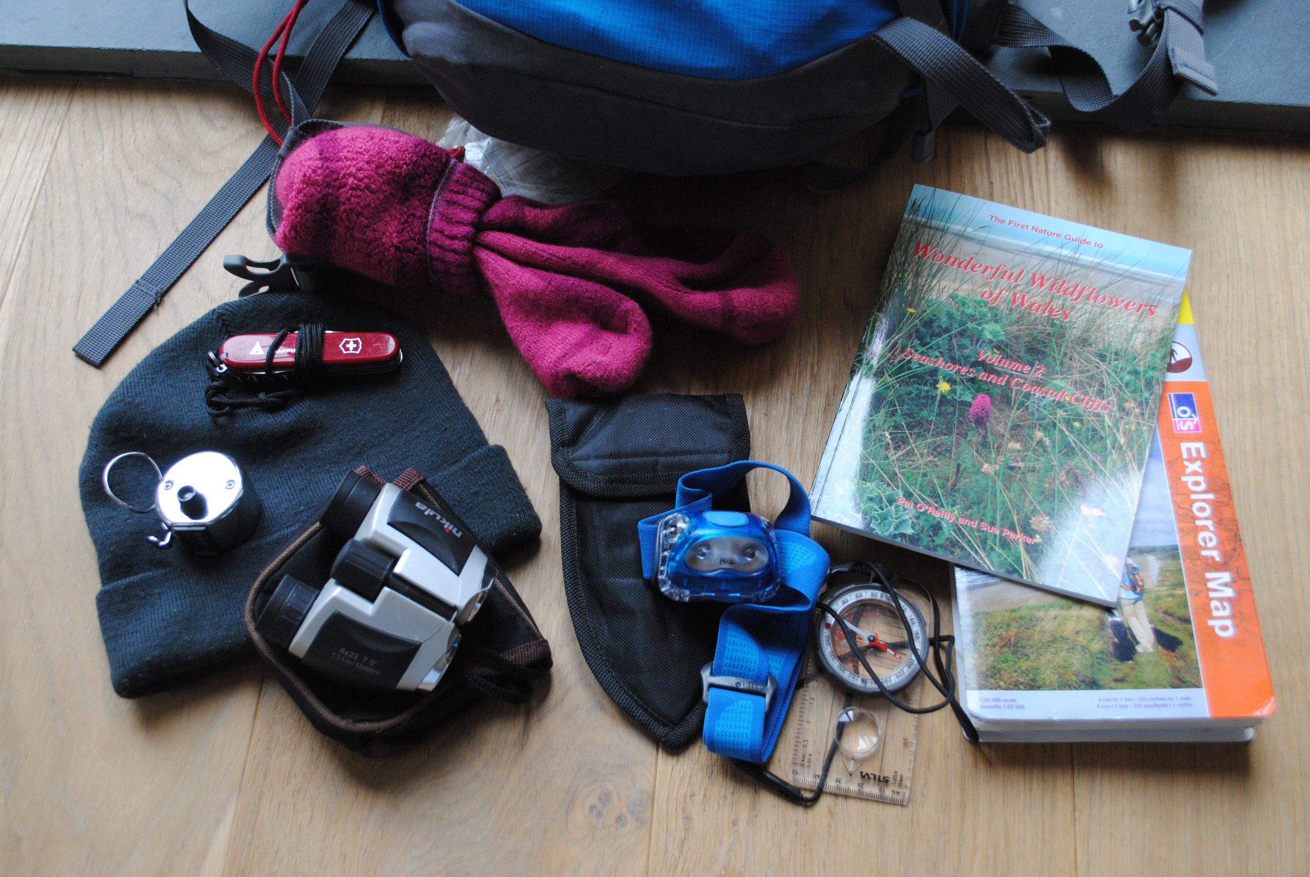
The map, a compass and my ‘clicker’, for calculating distances across the ground, where necessary were all to hand.
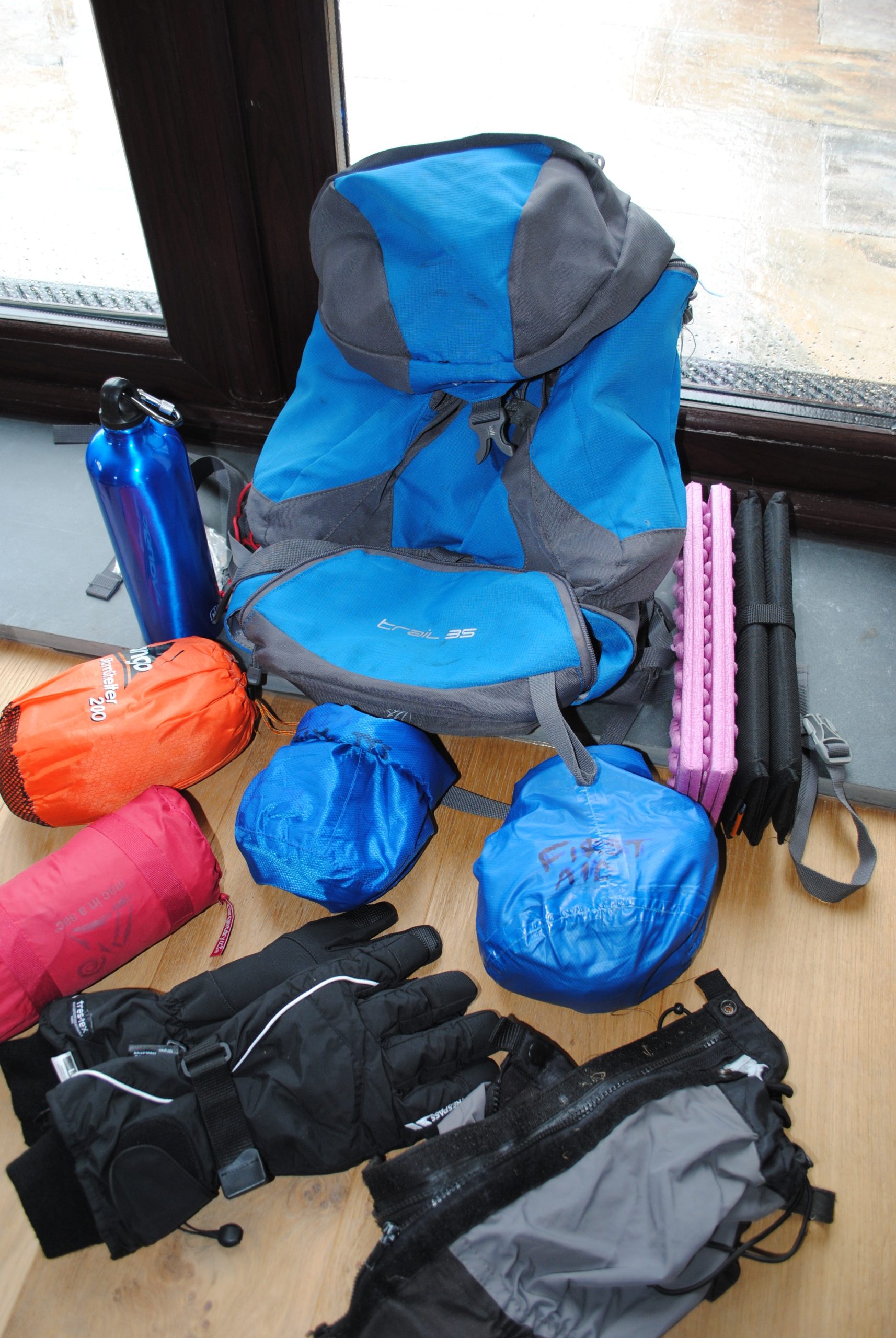
In our rucksacks we each carried a lightweight waterproof top and over trousers (they weigh little and role up small) and the usual spare pair of walking socks, woolly hats and, for Carol, her thin gloves. We also had these great little fold padded mats to sit on (about a foot square) to keep your bum dry at lunchtime! I carried the first aid kit, a bivvy bag and a bag of spares and repairs. The latter may be over the top for such a benign walk but you can never tell if/when you might need something and we would rather be safe than sorry. It’s also worth remembering that it might not be you who needs help and I have seen many people wandering along totally ill prepared themselves to cope with any unexpected occurrences and without a care in the world and I would like to feel that I was able to offer some assistance if I was first on the scene.
And I also had a mobile phone, the (small) binoculars and my (not so small) camera. Oh and I packed a small book on coastal birds and Coastal Flowers. (For further information on what to carry see my blog dated 15 May 2015 Top Ten Spares and repairs to Carry with You)
Food and Drink The weather again had implications for the food and drink. 13km of mainly coastal walking means plenty of ups and downs and plenty of sweating. Water (i.e. fluids) to maintain the body’s homeostasis process (replacing fluids in order to maintain a working core temperature) and food to nibble on to maintain energy levels. We really like to stop at the half way point and just soak in the views and that’s a great time to replenish ourselves so a good lunch spot, with a view, is another part of the planning process.
Walking Tip No 15: Pack your rucksack the night before and just add the food and water on the day. That way you are less likely to forget something. I confess I once forgot the map(!) and another time I forget my boots(!!). Now I pack the day before(!!!)
So we were ready in all respects for our walk. All of the planning skills referred to above are included in the walking modules available to novice and inexperienced walkers at Discover Walking Pembrokeshire. See our website for details.
In a few days time, I’ll blog about the actual navigational challenges of the walk itself.