 Although I am becoming more fiercely bias towards walking in North Pembrokeshire, I have to say that I have wanted to walk the Dale Peninsula for some time. I knew that it boasted some of the oldest rocks in Pembrokeshire and I knew that Henry VII (to be) landed there before marching on to Bosworth to take the English crown but I also knew that it had stunning views, hidden beaches and a wealth of other secrets to reveal. I walked the peninsula earlier this week with Carol and I was not disappointed.
The walk is about 7 miles long and has a total ascent of 668m. The conditions underfoot are typical of the coastal path – compacted dirt track and there is a bit of walking on the road towards the end.
 We started the walk at Kete car park (SM803 042) (which is free!) and headed North for a 150m before turning West to join the coastal path and then traveled South to St Ann’s head and then round to Dale before cutting back inland along rights of way and the road back to Kete car park. (Kete was the site of HMS Harrier – see my blog of 30 May 2015.)
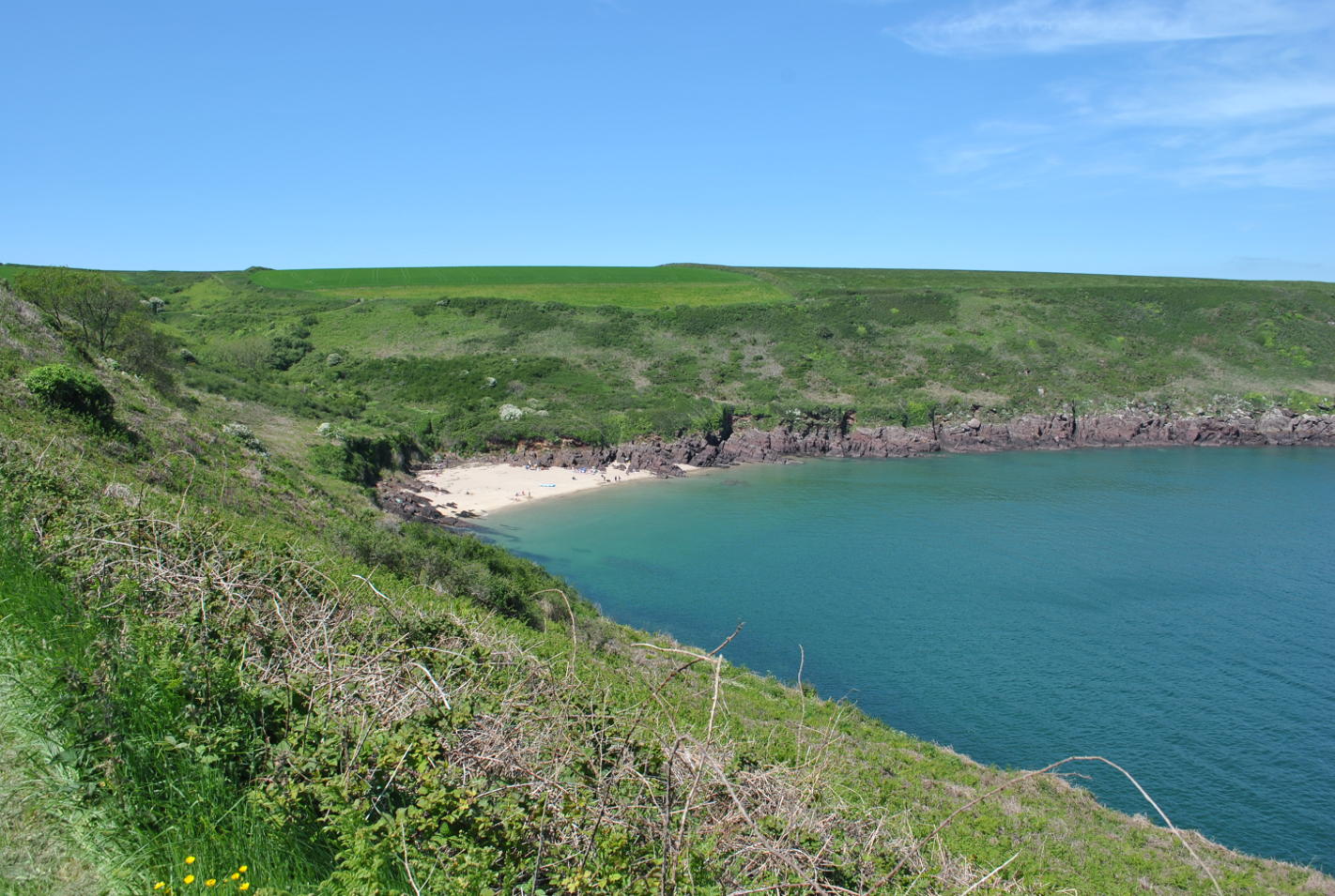
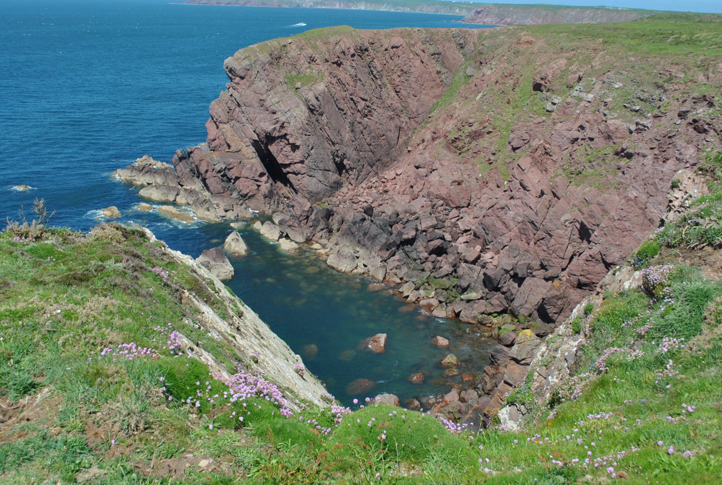
The first thing which impresses are the old red sandstone cliffs, 420-354 million years old and their colour contrast with the blue sea (it was another sunny day in Pembrokeshire!). And offshore in a slight haze lies Skokholm island along with Skomer a little further North – both massively important seabird colonies.
 There is a tangible sense of history across the whole peninsula and we were soon standing in an obvious bank and ditch structure – Iron Age at a guess – although Dale can also boast evidence of Neolithic farming. I love pre-history and never tire of imagining what life was like in those days for people living with their backs to the sea constantly looking out for danger. A theme I would be reminded of several more times during the walk.
History soon gave way to the flora -the coastal path and flowers is a natural pairing – like ice cream and jelly or toast and jam – it is just what you expect and this stretch does not disappoint but even so the concentration is still impressive. Sea thrift, sea campions and kidney vetch were dominant in most places.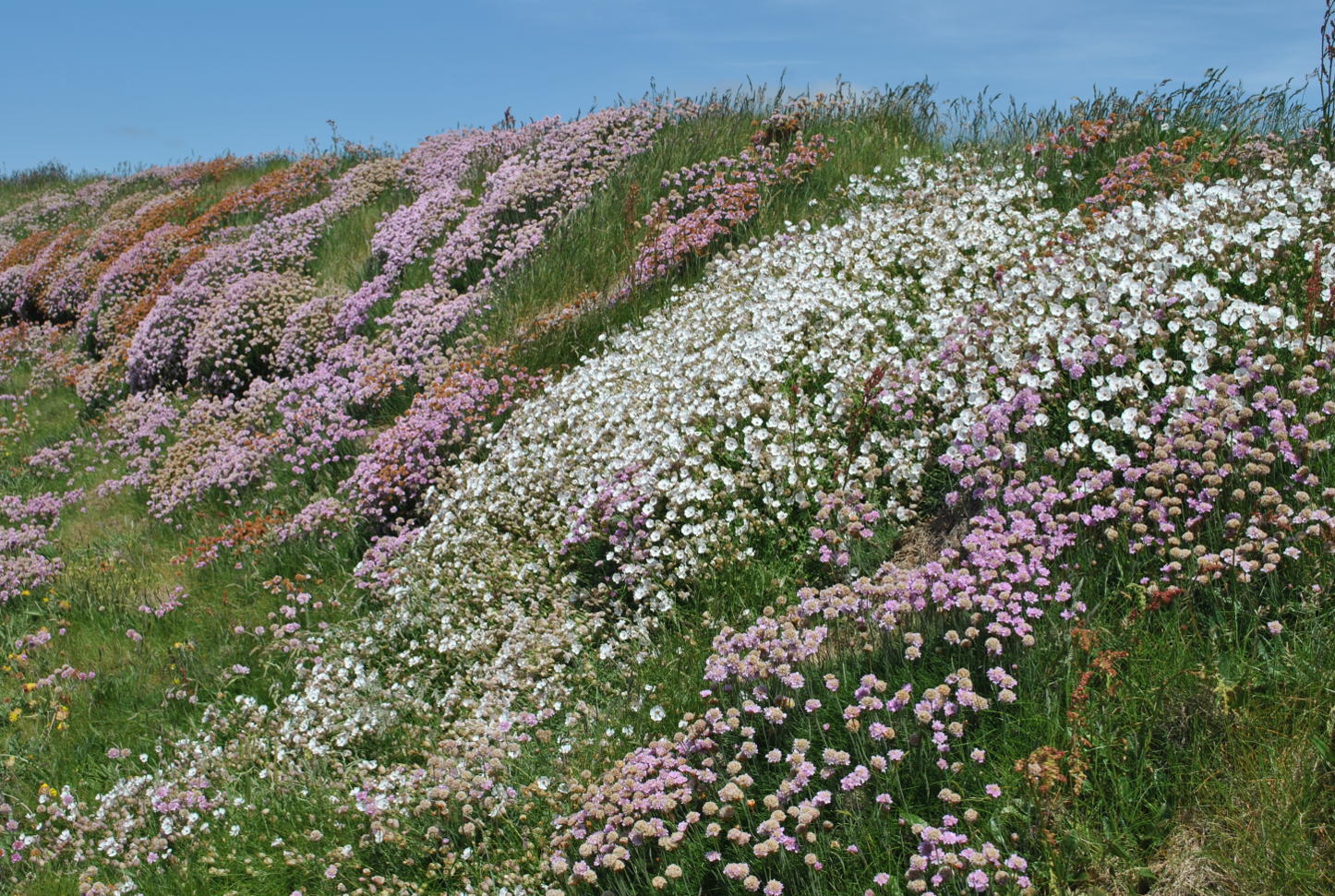
St Ann’s Head lighthouse and its helicopter pad soon rose into view ahead of us – a reminder that the offshore current and the unseen rocks below the surface of the sea could take and kill unsuspecting ships and sailors. The scene is complimented by the old lighthouse-men’s cottages – still proudly boasting their Trinity House colours of green and white and I wondered what it must have been like here in February of 1996 when the Sea Empress ran onto the rocks off St Ann’s Head, spilling 72,000 tons of light crude oil into the sea, eventually spreading along 120 miles of Pembrokeshire’s finest coastline. I remember my father taking me down to the coast at Sunderland the day after a storm in which a tanker had been driven onto the rocks.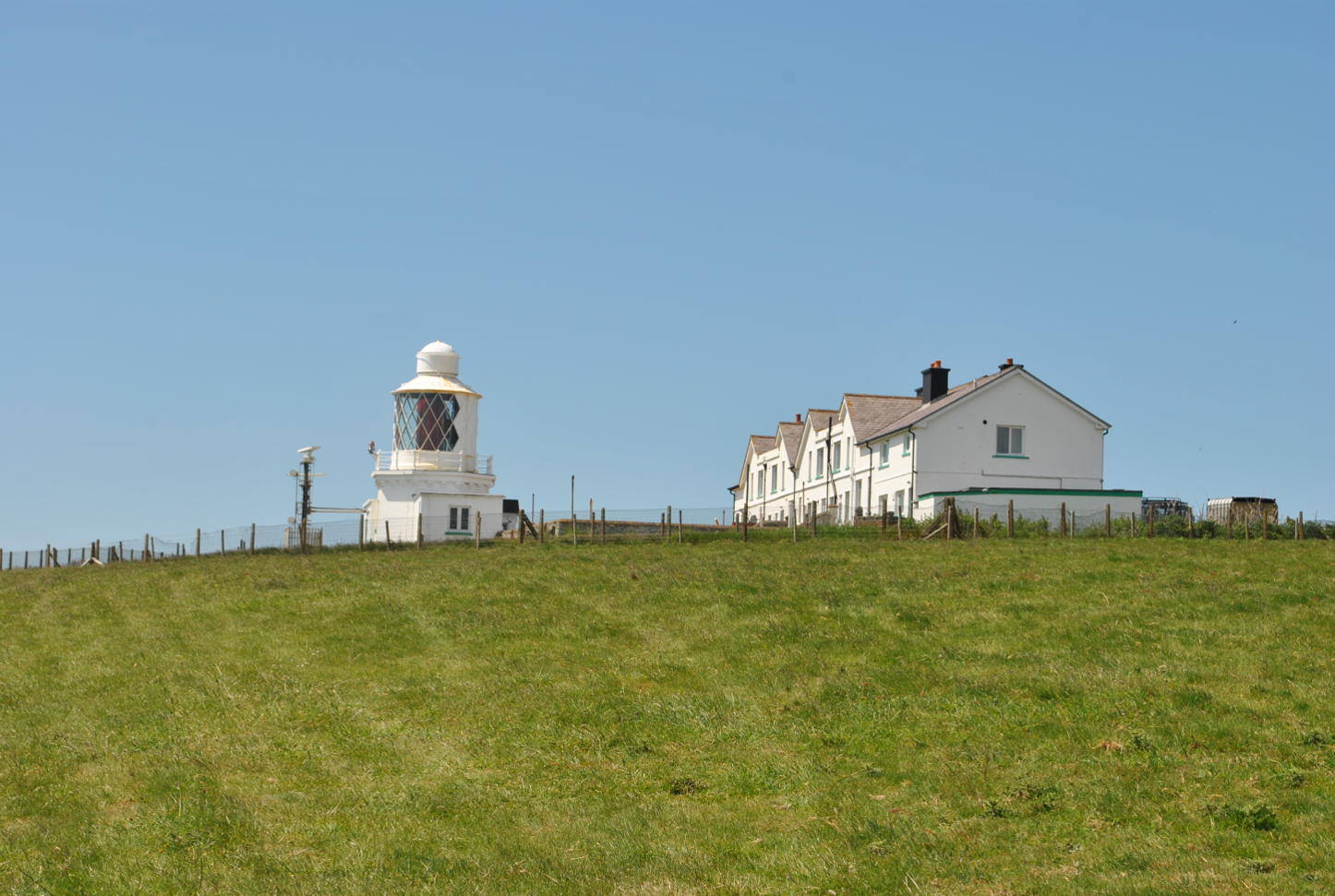 The image of that scene and the penetrating sound of metal scraping against rock as the ship was torn apart in an agonising death haunted me for years. And I wondered how similar it might have sounded on that day.
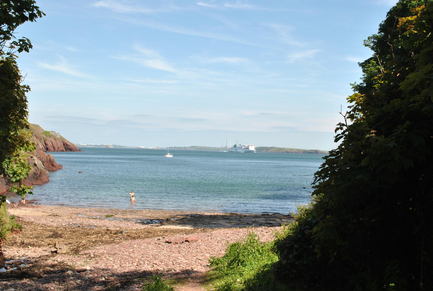
But reading the newspaper reports of the time, it appears that the disaster could have been a lot worse. Given that it was February, large colonies of migratory seabirds had not yet arrived back onto Skokholm and Skomer and the wind direction took most of the oil away from the bird sanctuaries. Also, chemicals were able to disperse much of the lighter crude which the Sea Empress was carrying. All that said it was still a disaster from which the environment took 10 years to recover. It was timely then that as we rounded St Ann’s we saw the full ‘glory’ of the oil and gas refineries at Milford Haven! I fully get the need for our island nation to import energy and I know that Milford Haven is a perfect deep-water harbour, but I hate that blot on the landscape with the same passion as I hate wind turbines standing on hills and other exposed areas ruining the natural beauty. I cannot begin to imaging the horror that local people felt as those monstrosities were built. In a mood of childish petulance I would not bring myself to take a picture!
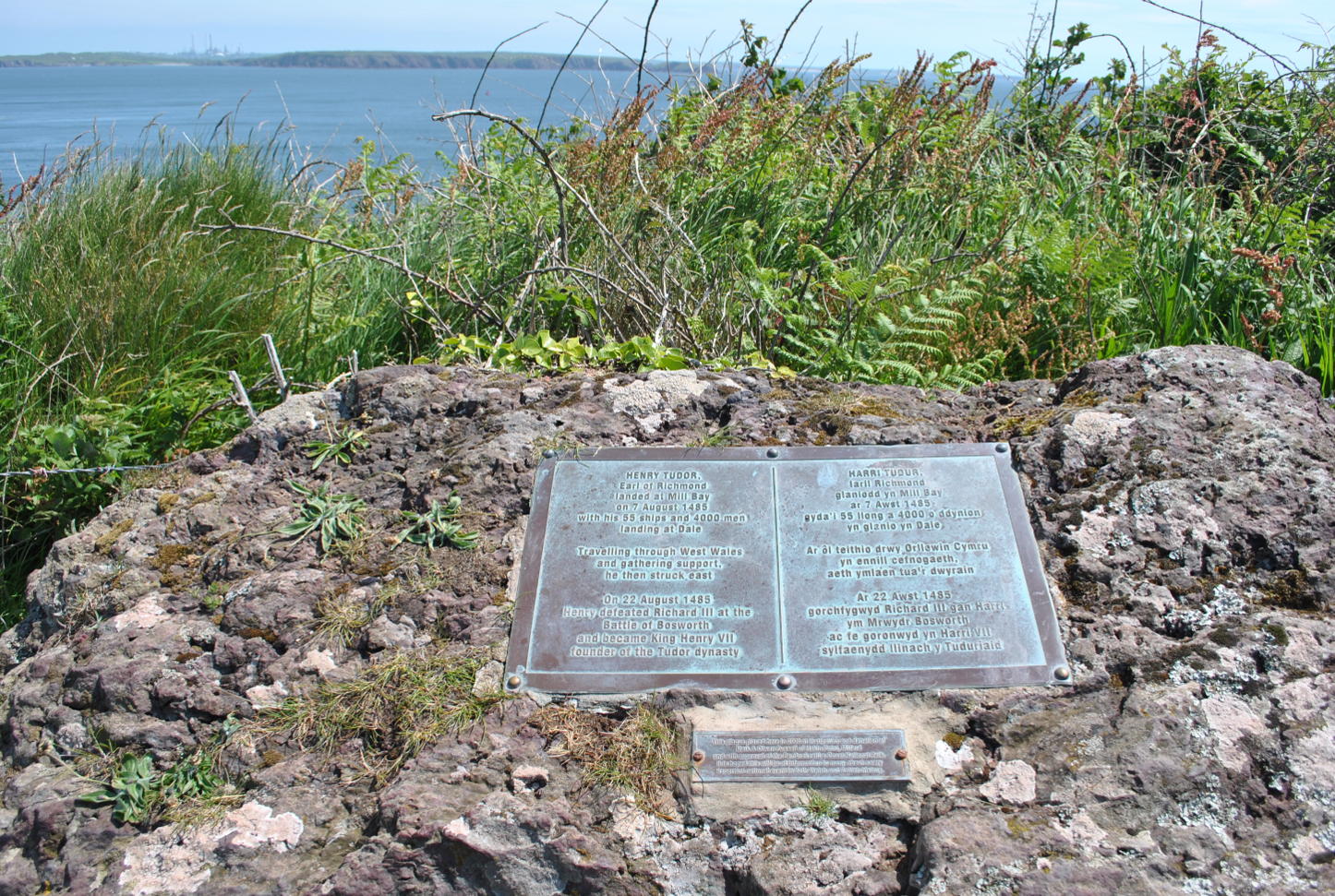 We were now in Mill Bay – this was where the Earl of Richmond – soon to become Henry VII – came ashore in August of 1485 with 4000 men to wrest the crown from Richard III and establish the Tudor dynasty in England. What a sight it must have been: 55 ships all anchored in the bay and Welsh princes with their armies waiting onshore to greet the soon-to-be first Welsh monarch on the English throne. There is a little plaque above the landing point to commemorate this massively important historical event.
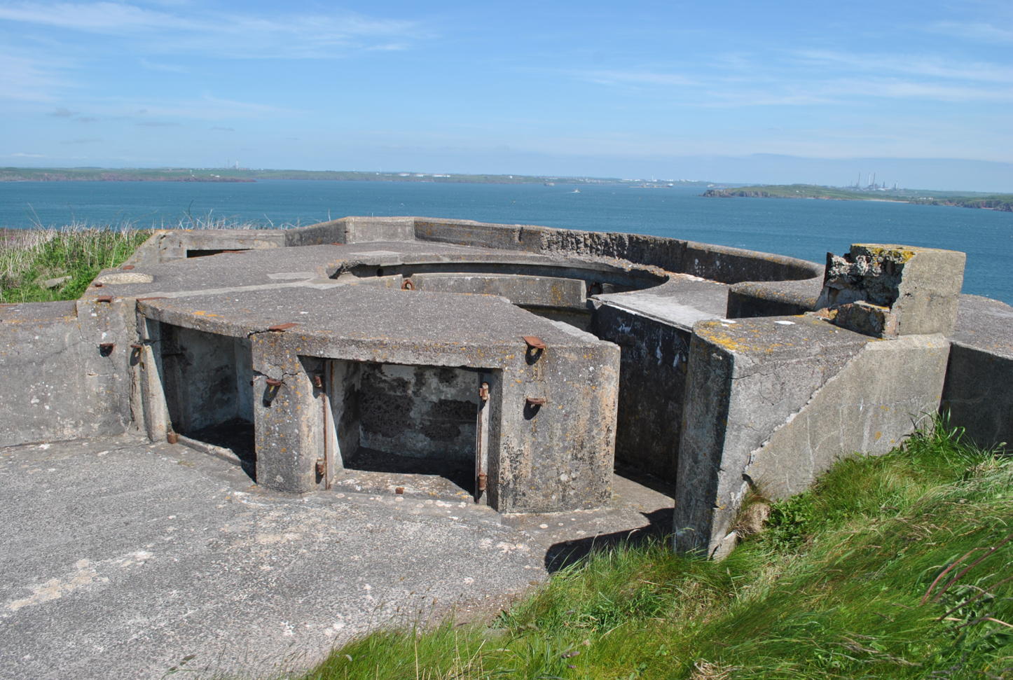 What is impressive about the peninsula is its concentration of history and by example, just 700m further along the North side of Mill Bay sits West Blockhouse – a powerful fort built with many others along the coast of Britain to repel a threatened French invasion in the 1850’s. It is ironic that just over 300 years before West Blockhouse was built, Henry VIII built the first fort on that same site, to repel invasion – so close to where his father stepped ashore! But it is the WWII gun emplacements – huge, broad, powerful, concrete structures pointing out to sea which bring our historic trip into modern times: this time the very real threat was German invasion.
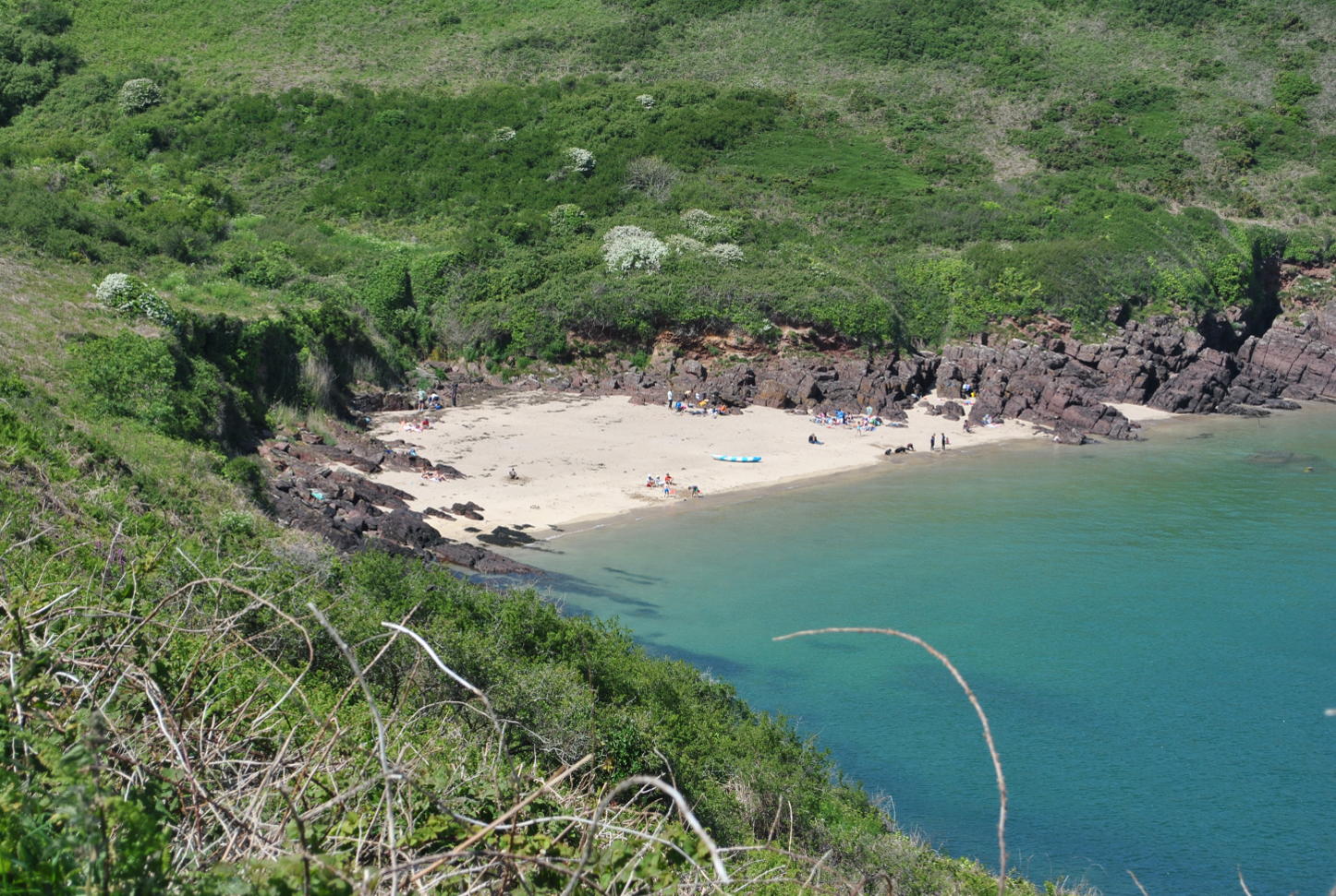
As we left these historic reminders behind us we came across two wonderful little beaches – both popular in this half-term week – Watwick Bay (left) and an un-named cove in Castlebeach Bay (right). And the latter had a great overgrown limekiln – another reminder of the past when lime was used extensively as a fertiliser as well as a component of building mortar and paint.
Our walk then took us passed the Field Studies Centre located within Dale Fort (built at the same time as West Blockhouse) where today students learn about the environment, including marine conservation and geography and we soon reached the outskirts of Dale itself. Resisting the call of the pub we climbed above Dale to begin our trek back to the car.
We did then head into Dale for that pint – enjoyed while sitting on the seawall watching the ‘half-termers’ playing on and in the water.
The walk took is about 5 hours because we stop every five minutes to look at something or to take a photograph – and why not.
A great walk – well worth doing.