Are you struggling to get away after a tough week at work? Or are other pressures preventing you from throwing your kit into the car and heading for the hills?
Well fear not: you can have a ‘quality hill skills day’ without the hills and without the day! That said, I would never suggest that you can beat a day (or two) away from the rat race because the views and the fresh air and the feeling of escaping are all hugely important reasons why you walk in the first place.
We are really lucky here in Pembrokeshire because the hills are on the doorstep and time is no longer an issue, but if you live in an urban area or if the hills are some distance from you, you can still make the most of any spare time you do have. All you need is an Ordnance Survey map of your area (I suggest the Explorer 1:25,000 scale) and a compass. And don’t let the weather put you off: remember there is no such thing as the wrong weather, only the wrong clothing!
So what walking skills can you practise in the urban area?
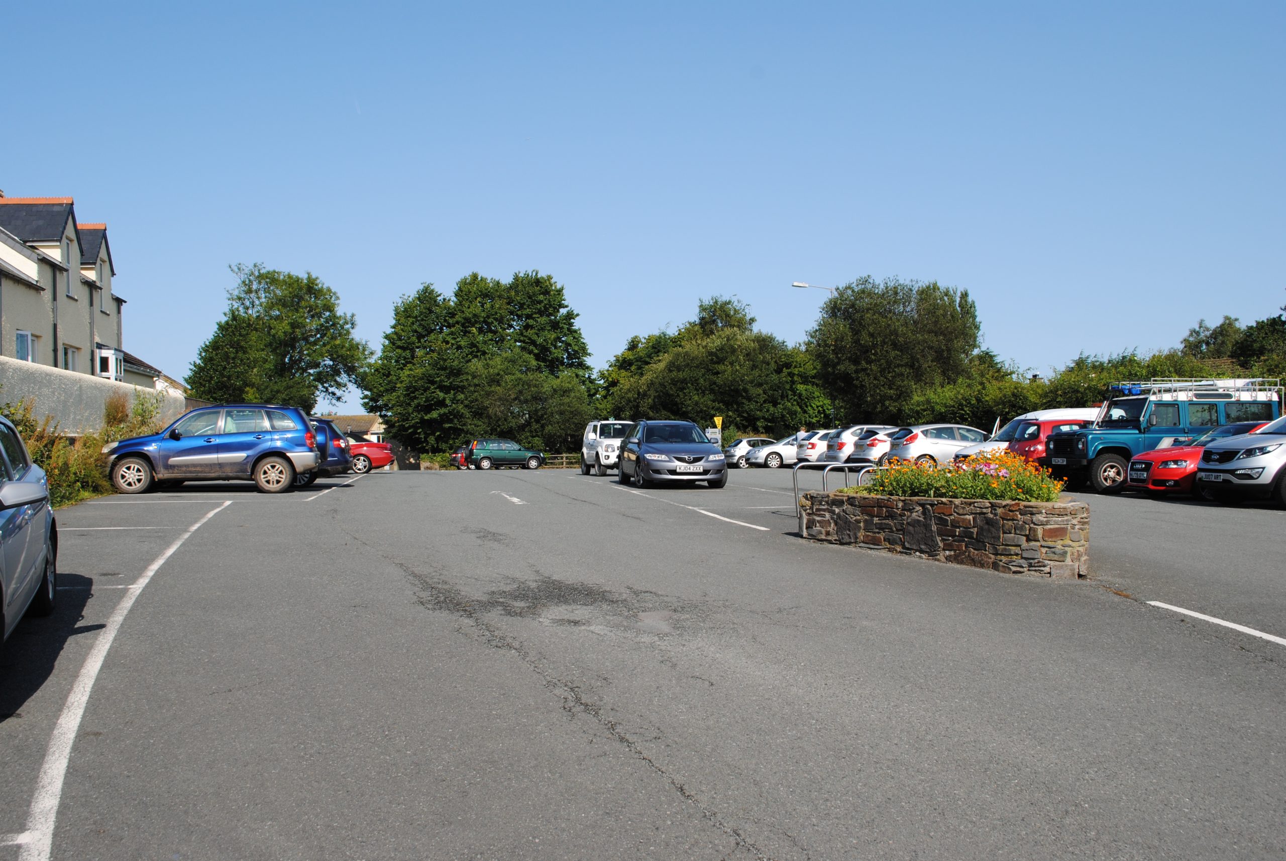
Pacing and Walking on a Bearing Do you have a playing field or a park you can walk around? If so, you can practise pacing and walking on a bearing. Starting from an obvious point that you will end up coming back to, simply pace out 100m and turn 90 degrees to your left. Pace out another 100m and turn 90 degrees left again. Repeat that four times and you should end up back at your starting point. I know it is easy to cheat but you are only kidding yourself if you do. Here is the car park in Newport, Pembrokeshire. I could do this pacing exercise using an oblong of 150m by 25m. The aim is to become confident at accurately pacing and walking on a bearing.
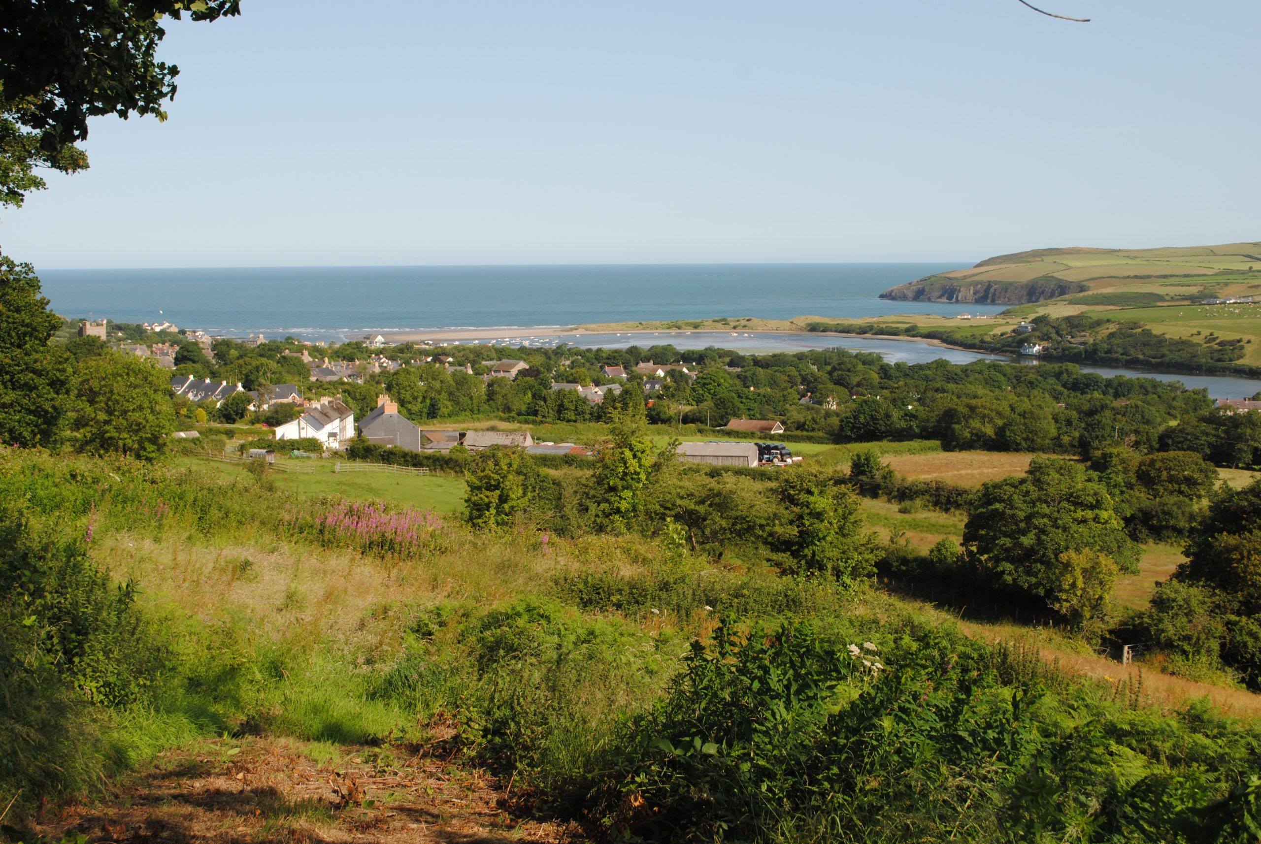
Estimating Distance Sit in the middle of a field or park and look around you. Estimate the distant to a small number of distinct features which you can see on the map (e.g. a bridge, a church spire, a roundabout etc) then check the distance according to the map. From the same position look again at the features around you and try to lock in what each distance ‘looks like’ so that you can usefully recall it when judging distances next time you are in the hills. This exercise is certainly better conducted if your field or park is on an elevated position – if not, perhaps there is some elevated ground near where you live and you can drive or walk to it. Even in the middle of a housing estate, if you can see features at a greater distance you will achieve plenty from this exercise. So for the picture below I would be estimating distance to the coast, the church (left) the nearest house, the edge of the forest etc. Judging distance accurately is a hugely important skill.
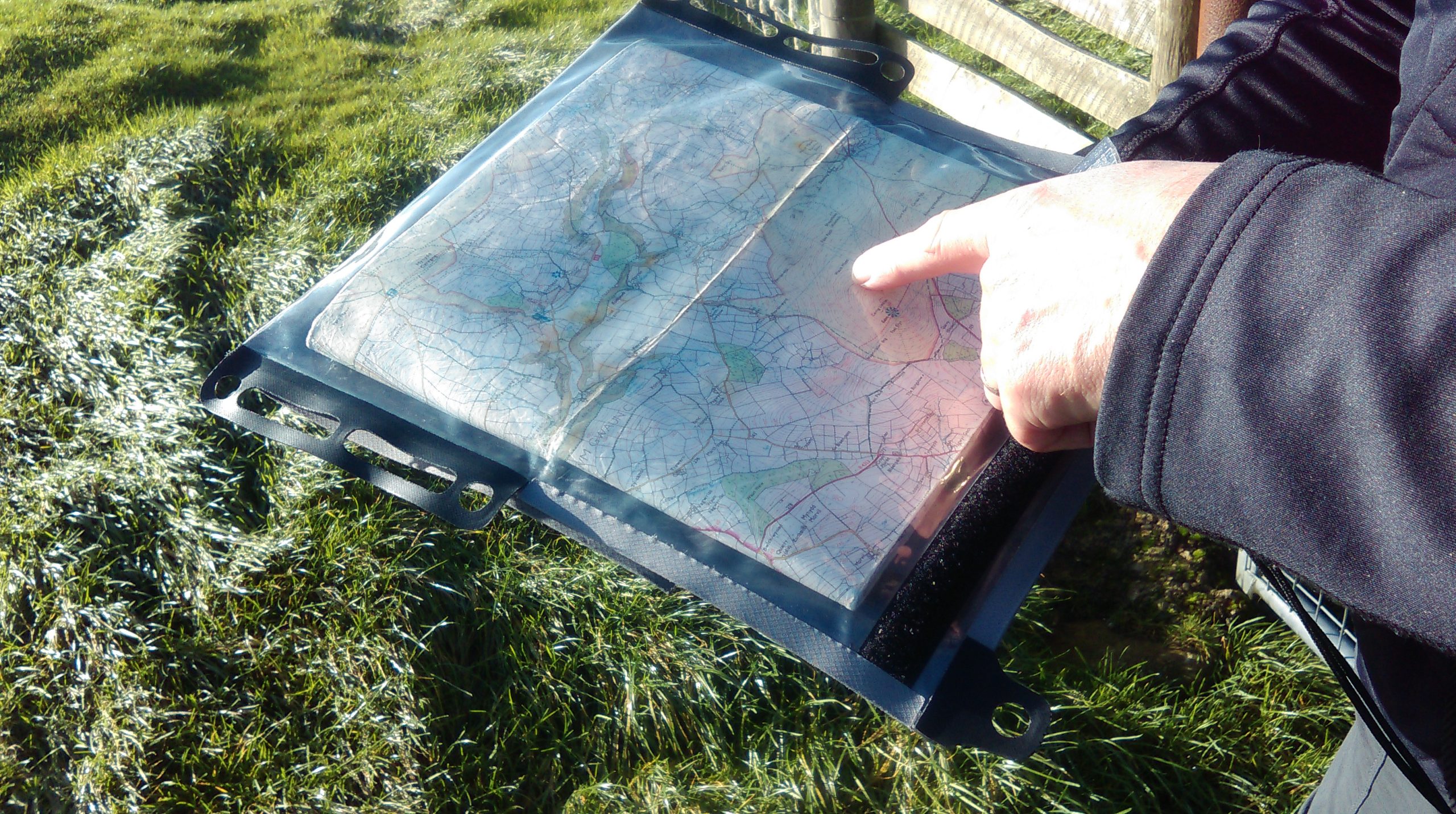
Taking a Bearing Using the same features, take their bearings on your compass and plot them onto your map. How accurate were you? Keep trying and the ‘cocked hat’ that you end up drawing will get smaller and smaller. It will make life so much easier when you come to take bearings in the hills.
Orientate Your Map Another useful exercise is to orientate your map using just the features you can see. And then orientate the map using your compass. Even in the middle of an urban sprawl, roads, roundabouts and parkland can provide all the features you need to be able to do that.
Relating Map to Ground and Ground and Map If you can get to somewhere that provides you with an elevated view start to understand the relationship between the map and the ground. As on the first photograph below, a hill that is steep on one side but slopes away gently on the other will be quite distinct on your map. As will be the field boundaries and the shape of the wooded area. In the second photograph the sides of a valley, the isolated farmhouse (ours!) and the distant hill will all be clear on the map.
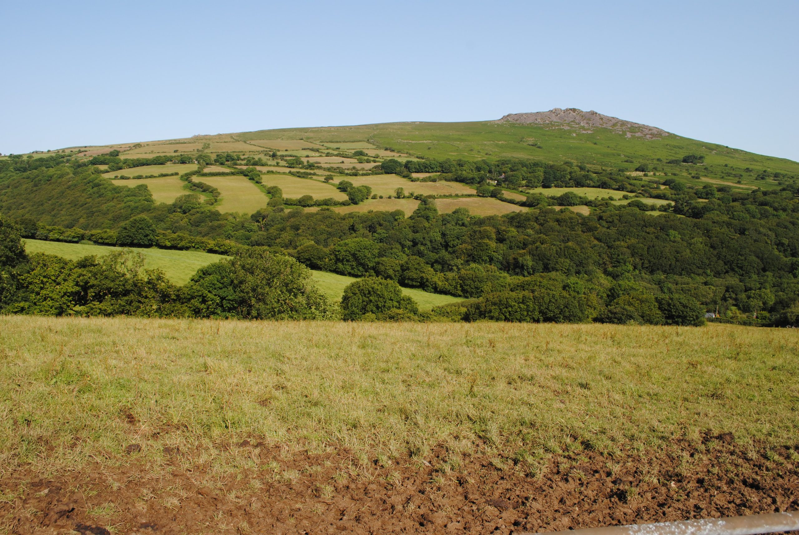
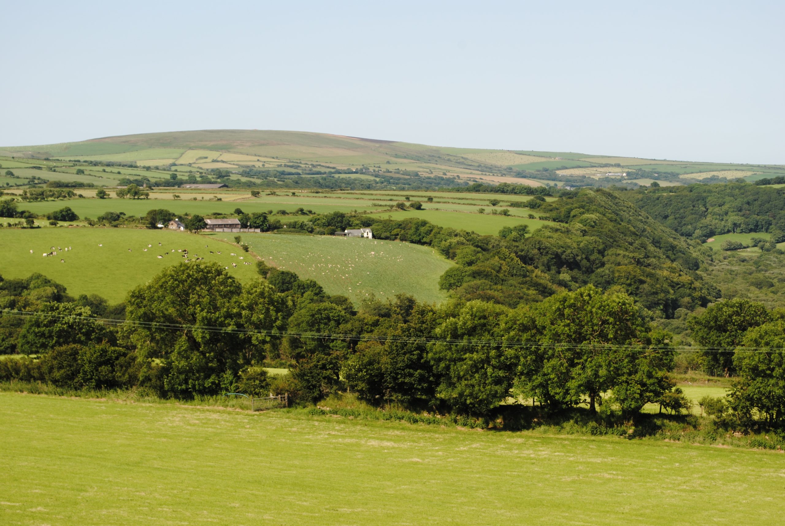
Really concentrate on linking the shape of the ground to the flow of the contours. This is a really key skill to learn. If you live near a river or the coast you will be able to discern its meandering shape and relate that to the map. But smaller features will also be marked: the ford next to a footbridge and a track leading away and don’t overlook the sloping ground through the trees. You should be able to find all these on the map. I know that they are countryside views but even next to rural areas you will be able to see rises and falls in the ground, river patterns and field boundaries. If you are really struggling drive into the countryside or try to gain access to a tall building and spend some time looking out of the window! A competent navigator will be able to look at these photographs and see many features which they could they relate to the map.

Don’t forget to do this exercise both ways round. Look at the ground and relate it to the map but also look for distinct features on the map and then look up to ‘find’ them on the ground.
Urban Route Planning This is a great exercise. Plan your route using all the steps you would if you were planning a hill route in a National Park. Work out distance, duration, distances for each leg, rest times, escape routes etc etc. The only difference is that your tick off features will be street corners, roundabouts, road junctions, railway stations, office blocks etc etc. Now you may think you will look daft navigating around Slough or wherever, but you can be discrete and an added objective for the walk could be to see if you can get all the way round without anyone realising what you are doing. I did this years ago when I was learning to use a GPS. Carol walked on the other side of the street! It’s amazing how many people stop and offer to help you with directions! If you are not willing to navigate up and down your local high street, then choose a semi rural area that you know and practice your skills there.
Single Leg Planning Rather than a whole route you could look at an urban map and identify a series of exercises over single ‘legs’. For example, if you worked out that M&S was 250 meters from TK Max then go and pace it and see how accurate your pacing is. Or, count the number of side streets coming into the high street on your map and calculate their distances apart. Then walk the leg, pacing or timing and see how you get on.
So you see, if you wake up on a weekend morning lamenting that you do not have time to get away for a quality hill day to practise your walking skills, think again. Use your imagination: get out there and ‘bag’ the local high street! (Bagging is walking lingo for conquering a hill or mountain). Who knows, urban bagging could be the new cool thing to do! Wicked!!
The above assumes that you have some knowledge of walking skills. If you do not or you are struggling to understand any of the techniques, have a look around our website and see if what we can provide to you or pick up the phone and have a chat.